Travel Western North Carolina
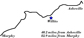
Following Wagon Trails - 1890s: Willits
Jackson County, N.C.
Altitude: 2,625 feet
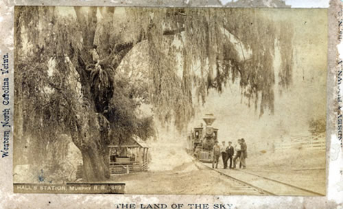
Hall Station, also known as Hall Siding, was located between the communities of Addie and Willets, N.C. This photographic postcard by Thomas H. Lindsey, entitled “Hall Station, Murphy R.R. 809,” was mentioned in Lindsey’s 1890 book, Lindsey’s Guide Book to Western North Carolina. In 1897 the Sylva Sentinel (Sylva, N.C.) newspaper listed Hall as one of six railway stations in Jackson County, along with Balsam, Addie, Sylva, Dillsboro, and Wilmot. Those six stations may be seen on the 1896 “Map of North Carolina” included in the book North Carolina and Its Resources, published by N.C. Department of Agriculture.
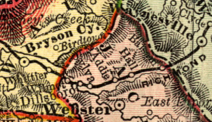
Map of Hall Station
 |
||
Return to the Southern Railway Map for the 1890s
Sources & Readings
- Jackson County Genealogical Society. Jackson County Heritage, North Carolina, 1992. Cullowhee, NC: JCGS, 1992 (Volume 1) and 2000 (Volume 2).
- Lindsey, Thomas H. Lindsey’s Guide Book to Western North Carolina. Asheville, N.C.: Randolph - Kerr Printing Co., 1890.
- McRorie, J.D. Knowing Jackson County: People, Places, and Earlier Days. Sylva, N.C.: Jackson County Historical Association, 2000.
- North Carolina, Department of Agriculture. North Carolina and Its Resources. Winston: M.I. and J.C. Stewart, 1896.
- Williams, Max R., ed. The History of Jackson County. Sesquicentennial ed. Sylva, NC: Jackson County Historical Association, 2001.