Travel Western North Carolina
Following Wagon Trails - 1890s: Candler
Buncombe County
Altitude: 2,120 feet
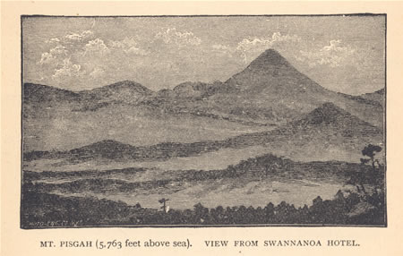
Wilbur G. Ziegler and Ben S. Grosscup’s The Heart of the Alleghanies provided readers with this illustration of Mt. Pisgah. By the time the book was published in 1883, Pisgah was earning a reputation for its distinctive setting, which was discernable from tourist areas in Asheville, N.C. The authors asserted that, “This latter peak is a famous height for the sight-seer. It is easily accessible, and from its summit the view is almost boundless. The broad valleys, watered by the Hominy and French Broad, stretch toward the eastern limit” (p. 123).
Candler, located at the junction of Hominy Creek and South Hominy Creek, was one of the communities hard hit by a torrential rain in 1893. Dillion M. Luther was listed on the 1900 U.S. Census as an attorney at law. According to the Heritage of Old Buncombe County (Volume 1), Russell Jones Gaston (1858 - 1921) operated a large store and a mill on Hominy Creek. Gaston appears on the 1900 census as a merchant.
Rains Cause Trouble
Slides and Washouts on the Railroads
The Track at the Swannanoa Tunnel Covered for a Distance of 30 Feet – Washout Near Fletcher’s – In Hominy Valley
"The unusually heavy rains of Saturday night, Sunday, and Sunday night have caused the railroad men no little trouble. . . . D. M. Luther, esq., came in from the Hominy valley today and reports great damage done to the farmers by last night’s rain. At Candler’s the bridge across Hominy is gone and the bottoms all the way to the French Broad are covered with the flood. The floor of Gaston’s mill at Hominy station is four feet under water and at Col. Joshua Jones’ the country has the appearance of a vast inland lake. The waters of Hominy creek have not been as high since 1876.”
- Asheville Daily Citizen, September 11, 1893
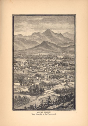
Mount Pisgah
West Asheville in the Foreground
Wilbur G. Ziegler and Ben S. Grosscup offered the readers of their book The Heart of the Alleghanies a second drawing that exemplified Mount Pisgah’s prominence on the skyline. Situated on the dividing line between Buncombe and Haywood counties, the mountain distinguishing shape drew the eye of the observer. According to the North Carolina Gazetteer, hikers or riders who ascended the mountain enjoyed views not only of North Carolina but also into Georgia, South Carolina, Virginia, and Tennessee.
 |
||
Return to the Southern Railway Map for the 1890s
Sources & Readings
- Powell, William S. The North Carolina Gazetteer. Chapel Hill: University of North Carolina Press, 1968.
- Swaim, Douglas, ed. Cabins & Castles: The History & Architecture of Buncombe County, North Carolina. City of Asheville, County of Buncombe: Division of Archives and History, North Carolina Department of Cultural Resources, 1981.
- Ward, Doris Cline, ed., Charles D. Biddix, associate ed. The Heritage of Old Buncombe County. Asheville, N.C.: Old Buncombe County Genealogical Society, 1981.
- Zeigler, Wilbur G. and Ben S. Grosscup. The Heart of the Alleghanies; Or, Western North Carolina; Comprising Its Topography, History, Resources, People, Narratives, Incidents, and Pictures of Travel, adventures in Hunting and Fishing and Legends of Its Wilderness. Raleigh, N.C.: A. Williams & Co.; Cleveland, O.: W.W. Williams, 1883.